Cerro Chirripó has an altitude of 3,820 (12,530) meters above sea level and forms a part of Parque Internacional la amistad de Costa Rica. It is the 38th highest peak in the world. It does not compare to the Rockies in Colorado that I enjoyed so much climbing as a child but the hike is still very grueling.
We arrived in a quaint little town of 305 called San Gerardo de Rivas on friday afternoon. It was a beautiful day, there wasn't a cloud in the sky. We didn't have reservations so we immediately went to the Park Ranger office. A very helpful park ranger named Jose helped us plan our upcoming adventure. We decided that we would get up early saturday morning (4 am) and start the ascension. We would ascend 15 km to base crestones (the base camp), stay overnight and then the next morning ascend the last 5 km to the summit and watch the sunrise over the Caribbean sea. Almost everything went as planned.
We got up as planned the next morning and had a hearty man's breakfast of Gallo Pinto, Eggs, Tortillas ,Natilla (kinda like a sour cream) and of course a cup of coffee. After feeling completely satiated, we decided it was time to make the ascent. With about 10-15 kilos of weight on our backs filled with sleeping bags, warm clothes, food (mostly tuna) and 2 liters of water, we started to climb. The lady at the hotel told us that the 2km walk from the hotel to the trailhead was a good way to "warm-up" the body. And yes it was a good way to warm-up...if you are Sir Edmund Hillary or some other expert climber!!! Nevertheless, we made it to the trailhead and we took a picture by the 0 KM mark. We had to pass by 15 more of the KM marks throughout the day.
The first KM we ran into a problem. Andrew, a fellow PVC, felt as thought he was starting to develop a blister on his foot. We stopped and he was able to bandage it up but unfortunately the blister would continue to get worse and prevented him from reaching the summit. He made it 15 KM and practically tore off all the skin, one of the worst blisters I have seen. It is impressive that he was able to make it to base crestones.
The next seven KM were fine and we ended up splitting into two groups. Jonathan and I were in the front group and John and Andrew were behind us. We planned that we would eat lunch at KM 7 before the big ascension of 8 and 9. The park ranger warned us beforehand that the hardest KMs of the trek were KM 8,9 and 13, We had to bring all of our food in our bags. We didnt have a stove so it had to either be canned or perishable food. Our diet consisted of tuna, trail mix and fruit. We ate a pretty hearty lunch and then decided to ascend the 8th and 9th KM.
It was a steep incline going up KM 8 and 9. The sights and sounds of our surroundings distracted our minds from our heavy breathing: birds chirping, hummingbirds fluttering, trees being swallowed by mist and sharp cliffs leading to vast valleys. It was a breathtaking two KMs (pun intended).
KMs 10-12 were different than the previous KMs. By KM 10, we were out of the canopy and there were no more tall trees. The vegetation was also different. There was less green and it looked a lot like the Southwest US but with more shrubs. My friend, who had studied in Spain, said this landscape reminded him of the arid landscapes around Madrid. Right when the we left the canopy, the rain came and it was an aguacera (downpour). We were about 3000 meters above sea level so not only was it pouring rain but it was also extremely cold.
And then we finally made it to the homestretch, 1.5 KM to base crestones. This 1.5 KM was not just another couple KM, it was the hardest stretch of the trail. We filled up our water bottles at before we started and we were off. As we ascended it became colder and colder and the air became thiner and thiner. We knew we were almost at the base camp so that gave us motivation to continue hiking. Finally, we came upon a steep cliff jetting down into a small valley (valley of the rabbits/ valle de los conejos) and there was the base crestones. We checked-in and were ready for some more nourishment.
And then we finally made it to the homestretch, 1.5 KM to base crestones. This 1.5 KM was not just another couple KM, it was the hardest stretch of the trail. We filled up our water bottles at before we started and we were off. As we ascended it became colder and colder and the air became thiner and thiner. We knew we were almost at the base camp so that gave us motivation to continue hiking. Finally, we came upon a steep cliff jetting down into a small valley (valley of the rabbits/ valle de los conejos) and there was the base crestones. We checked-in and were ready for some more nourishment.
We made it to the base at about 3:00 pm and the sun was covered by the clouds. With no sun the temperature was close to freezing, and we had to put on all the clothes we carried up in order to stay warm. There was no snow, but the next morning we saw ice. We had a dinner that included tuna (again), avocado, cheese, bean spread and heart of palm. During dinner we met a french man and his american wife. They were on a biking adventure and are planning to bike all the way to Patagonia. They told us they prefer to go mountain hiking and decided to have to quick detour in order to climb Chirripo.
After dinner it was bed time because we planned to wake up at 3:00 and be on the top by 5:00 to watch the sun rise. It was extremely cold in our room during the night. The tile floor was so cold it was hard to walk on it bare-foot for more than a minute. I rented a sleeping bag from the hotel we stayed at in San Gerardo but it did not cover my body entirely. It was not a good night sleep. Nonetheless, we awoke as planned at 3:00 am and the four sleep-deprived PCVs headed for the summit.
Unfortunately, my friend had acquired a blister the day before and it was too painful for him to continue to the summit. He decided to return to the base. We continued and about 30 minutes into our trek, we realized that we were on the wrong path heading the opposite direction of Chirripó. We were upset that we didn't plan and find the trailhead the day before. We made it back to base camp and it was about an hour detour. We found the correct trailhead and started hiking the right way this time. It was still completely dark and we had to use our headlights to find our way.
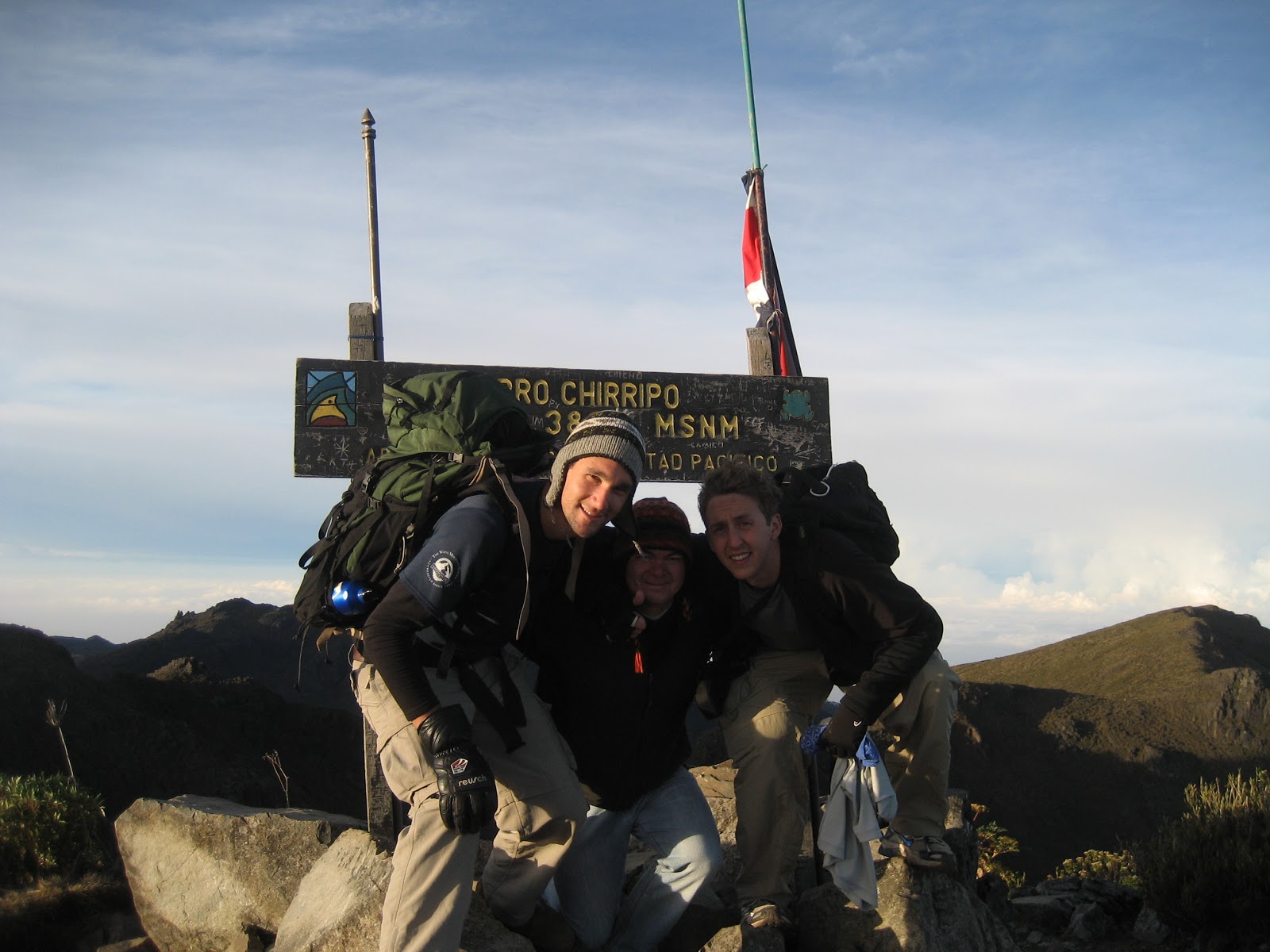
Just when the sun was popping over the horizon, we climbed to over a ledge and there before us, powerful and majestic and previously not visible, was the summit of Chirripó. From this distance, we could see a tiny bluish speck waving in the distance; it was the Costa Rican flag on top of the summit. We kept moving with little rest to avoid getting chilled. A half an hour later, we were standing on the highest point in Costa Rica.
 |
| Trailhead |


 |
| San Gerardo de Rivas |